Community Enhancements
The Federal Highway Administration (FHWA) recommends Context Sensitive Solutions (CSS) as enhancements to transportation infrastructure projects which help to mitigate impacts of the highway and, as part of the Community Connections program, attempt to stitch back together communities historically divided by federally funded highways. Refer to FHWA’s Community Connections Innovations Handbook for details.
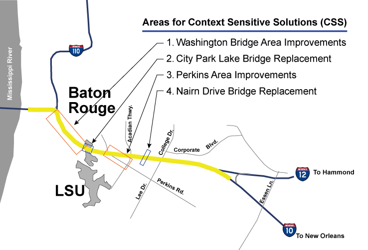
Four CSS improvements have been recommended as part of this I-10 Widening project through Baton Rouge and are incorporated into the Environmental Assessment documentation which was approved as a FONSI (Finding of No Significant Impact) by FHWA in February of 2021. The four I-10 BR CSS areas are described here, listed from west to east along the corridor. Planning for these improvements included a robust community engagement process involving in-person meetings, amenity preference surveys, and corresponding online surveys to involve a wider audience.
Provision of amenities described on this page and in the plans is contingent upon maintenance agreements by others. For some of the amenities, locations within State right of way would be provided by DOTD while installation and maintenance must be accomplished by others. These and other details are being negotiated as the project progresses through final design.
Washington Bridge Area Improvements
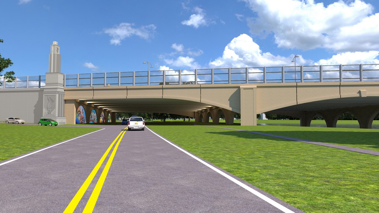
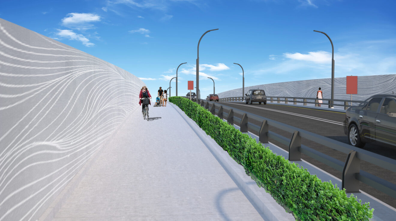
The Washington Bridge is that portion of elevated I-10 which passes over Lorri Burgess Avenue which was previously named E. Washington Street during the project environmental assessment stage. Improvements include a multi-use pathway (referenced as a greenway), decorative LED and nighttime safety lighting, limited landscaping in focused areas, specialized pavement treatments for plazas, and replacement of parking areas beneath the interstate.


Use the interactive image below to zoom in and pan around the master plan of improvements proposed for the “Washington Street bridge” area, which extends from BREC’s Expressway Park beneath the I-110 interchange at the top to Dalrymple Drive along City Park Lake at the bottom of the image.
City Park Lake Bridge
The I-10 bridge over City Park Lake, Dalrymple Drive, and E. Lakeshore Drive is being replaced as part of this project. The new bridge will feature aesthetic enhancements including arches in the support structure, four 80-foot-tall towers positioned at the four corners of the bridge, decorative relief engravings replicating the art deco styled pelican motifs found on existing I-10 noise walls and also on the Louisiana State Capitol building, enhanced lighting standards on the road deck, decorative LED lighting beneath the bridge, and opportunities for public art (provided by others) within designated archways on the bulkheads.


Use the interactive image below to zoom in and pan around the illustration of the new I-10 bridge over City Park Lake in Baton Rouge.
Perkins Overpass Area Improvements
I-10 passes over Perkins Road at a location dense with restaurants, bars, shops and other businesses which are unique to and cherished by Baton Rougeans. These businesses rely on the under-interstate parking presently provided through Joint Use Agreements (JUAs) as undefined gravel lots. This will be replaced with paved parking. Also, the on/off ramps at Perkins Road will be permanently removed as part of the overall project – making available State right-of-way for recommended CSS improvements including an extension of Greenwood Drive to Perkins Road.


Use the interactive image below to zoom in and pan around the illustrative master plan showing recommended improvements to the Perkins Overpass area resulting from design team efforts, public engagement and agency review in 2023.
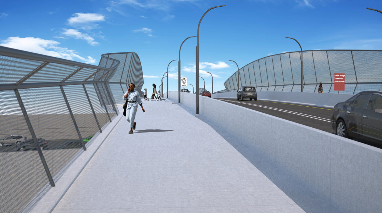
Nairn Drive Bridge
To add travel lanes to I-10 between S. Acadian Thruway and College Drive the Nairn Drive bridge spanning the interstate must be replaced. The new bridge will have a wider span, and community engagement efforts provided guidance in designing new bridge characteristics adopted within the project’s Environmental Assessment document. These include incorporation of a multi-use path eventually linking Bawell Street at the north to Perkins Road at the south, and pedestrian scaled nighttime lighting over the bridge. The illustrations below are very preliminary and will be replaced with updated illustrations when final design is complete.
As the project design team develops the final design for the interstate there may be opportunities for additional community engagement to receive feedback on possible CSS improvements within one or more of these areas. Public notices and media promotion of such events, should they occur, will be published through this website and to the e-newsletter subscriber list in addition to local media announcements.