Phase 1
From W. of Washington Street to Essen Lane on I-10 and I-12
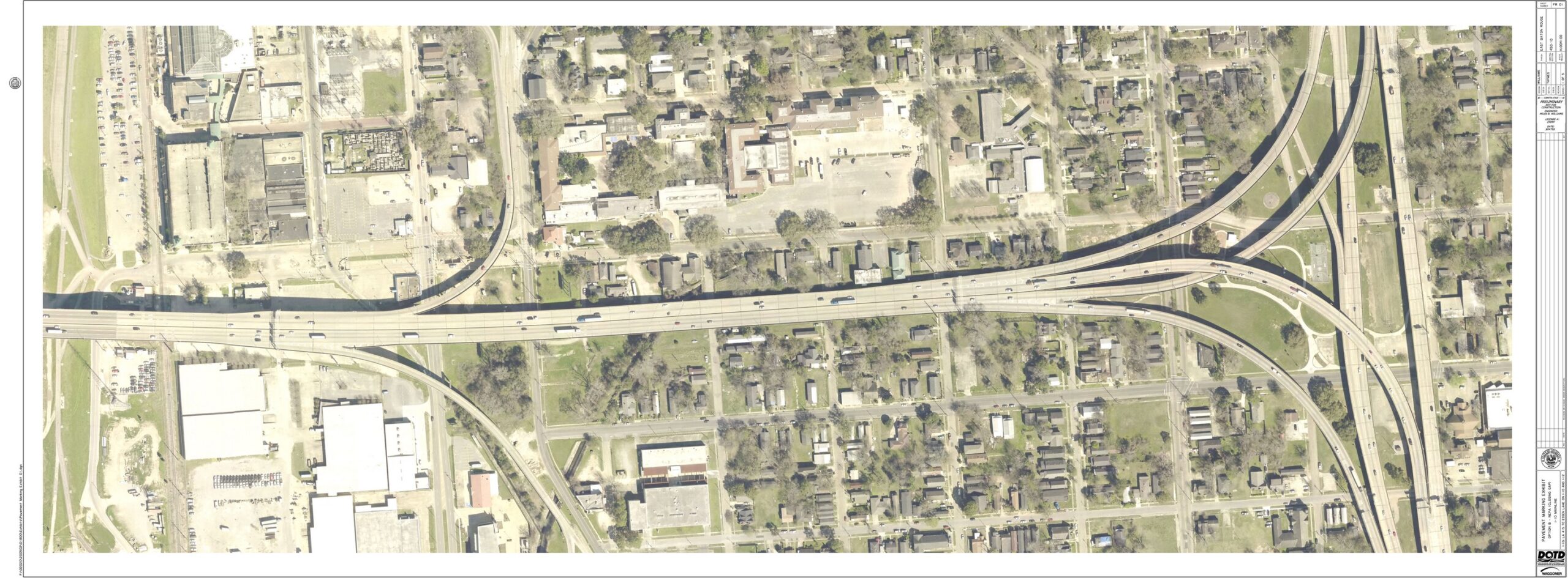
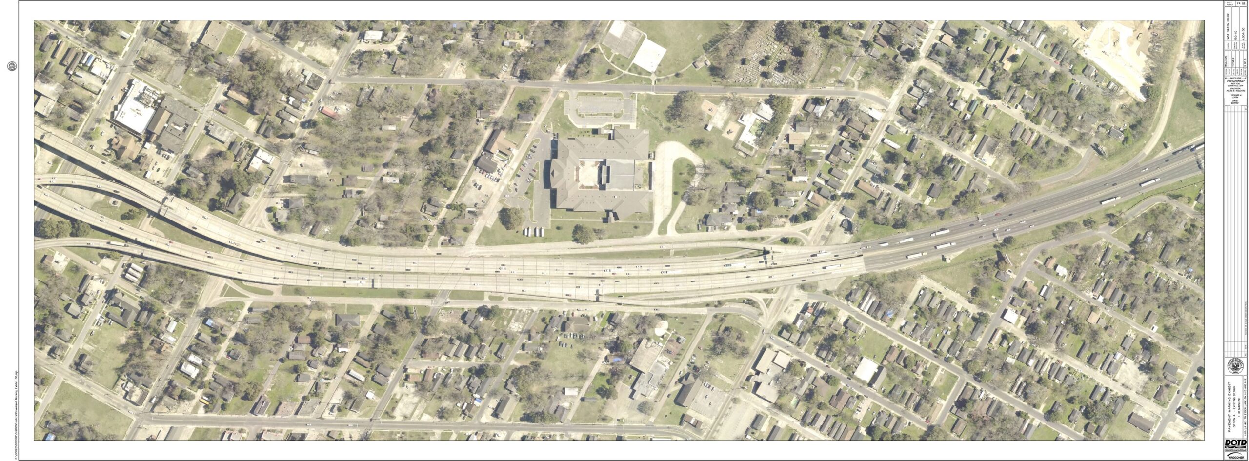
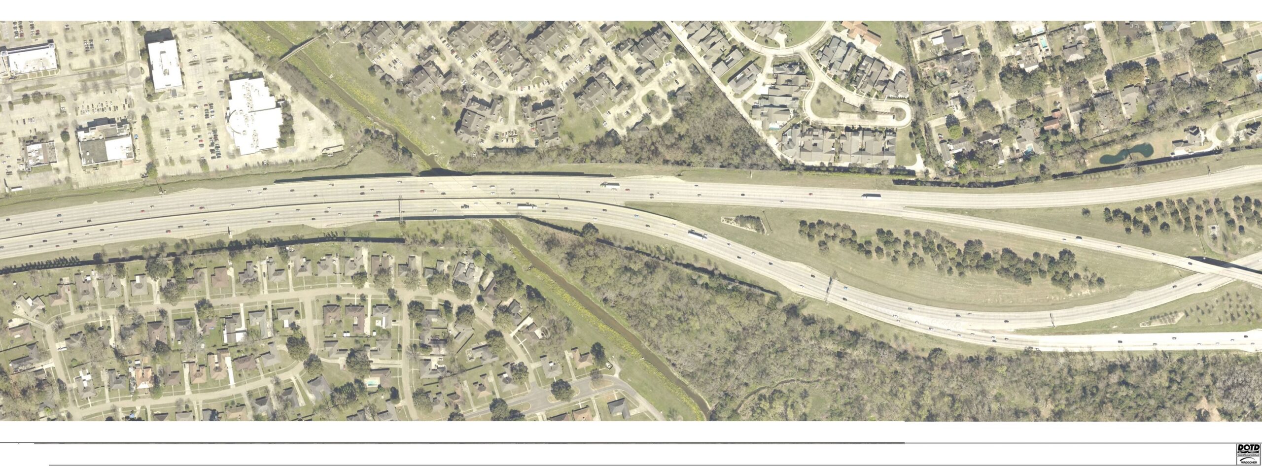
The following series of images display the sequence of plan sheets for Phase 1 from west to east, beginning west of Washington Street and extending to the I-10 / I-12 split. Use the vertical slider bar on each image to reveal the current I-10 corridor conditions (aerial photo) on the left side versus the roadway plans on the right side. A button in the lower, right corner of each exhibit will enlarge it to fill your screen. Plans are subject to change as they reach final design.
Key improvements shown on plan Sheet #1 include:
- The two through-lanes of I-10 eastbound will join two southbound lanes of I-110 to form four through-lanes of I-10 eastbound.
- A widened I-10 westbound “flyover” curve to the Mississippi River bridge will offer improved line of sight.
- The I-10 eastbound curve will be rebuilt, also offering improved visibility.
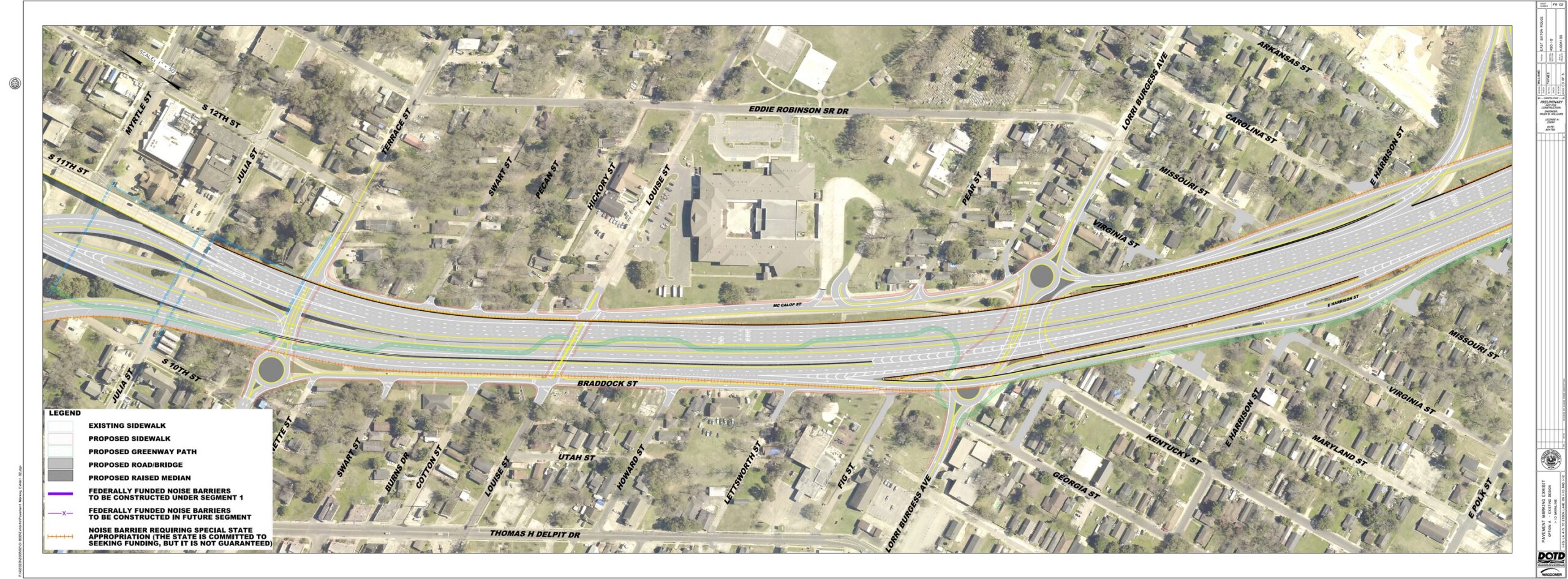
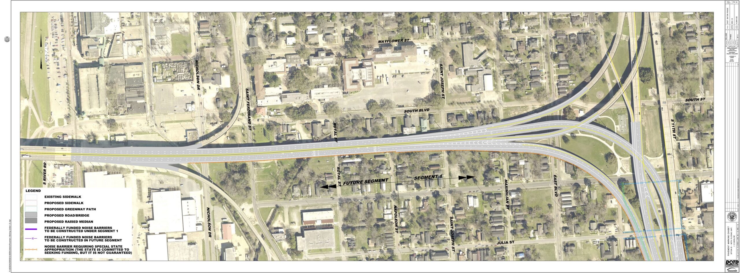
Plan Sheet #2 displays the following improvements.
- The I-10 eastbound exit to Washington Street is removed and consolidated with the Dalrymple Drive exit.
- The I-10 westbound on-ramp from Louise Street is removed, eliminating potential weaving movements.
- Braddock Street is extended along I-10 eastbound, connecting to Dalrymple Drive.
- Roundabouts are introduced on Lorri Burgess Avenue (Washington Street) on both sides of elevated I-10, and also a roundabout on Terrace Street at Braddock Street.
- A U-turn option is provided from Dalrymple Drive for travelers heading east on I-10.
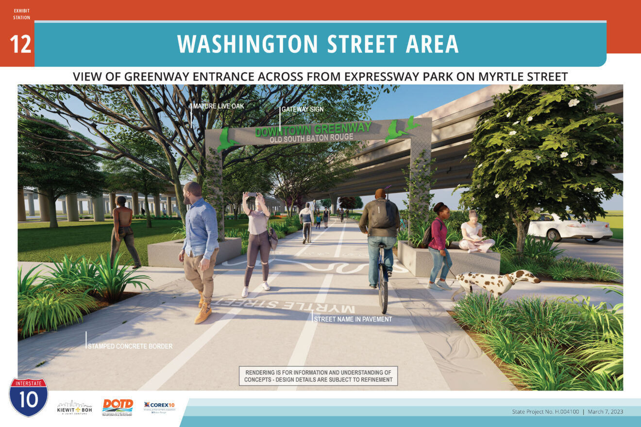
- A new multi-use greenway path will link BREC’s Expressway Park (terminus of the existing Downtown Greenway) with future bicycle and pedestrian facilities along Dalrymple Drive and around City Park and University Lakes (by others.)
- New or replaced sidewalks along surface streets.
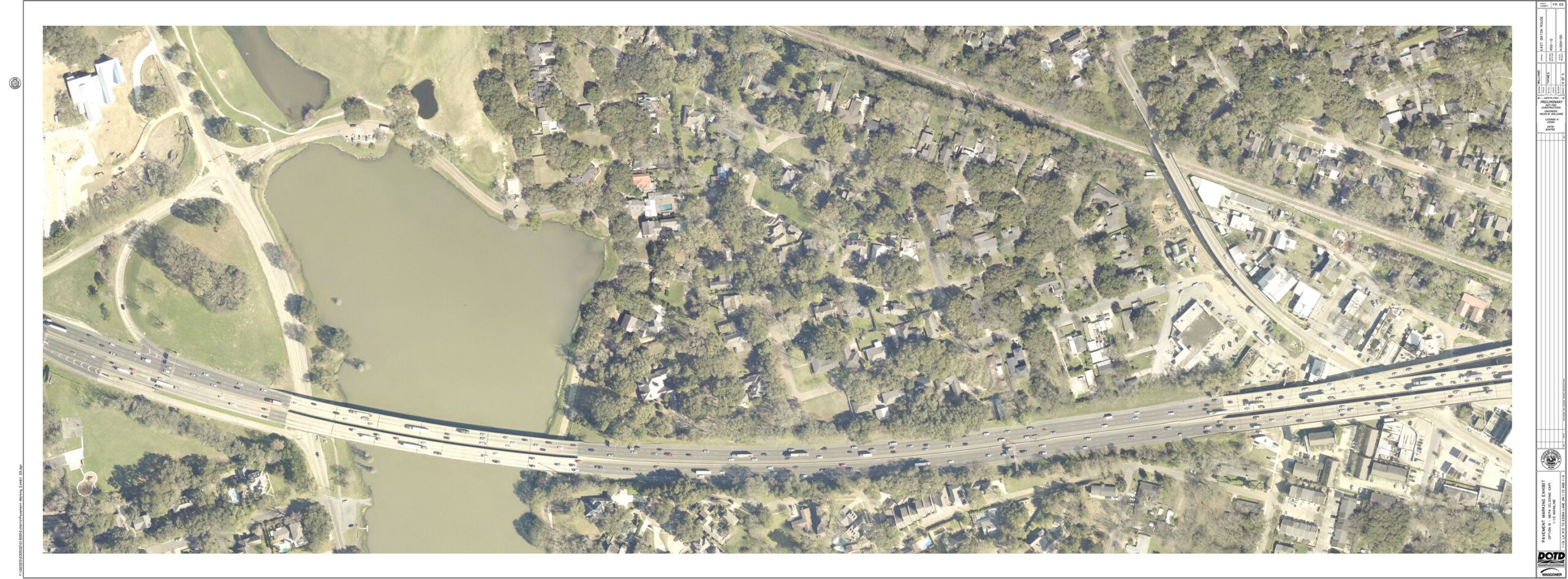
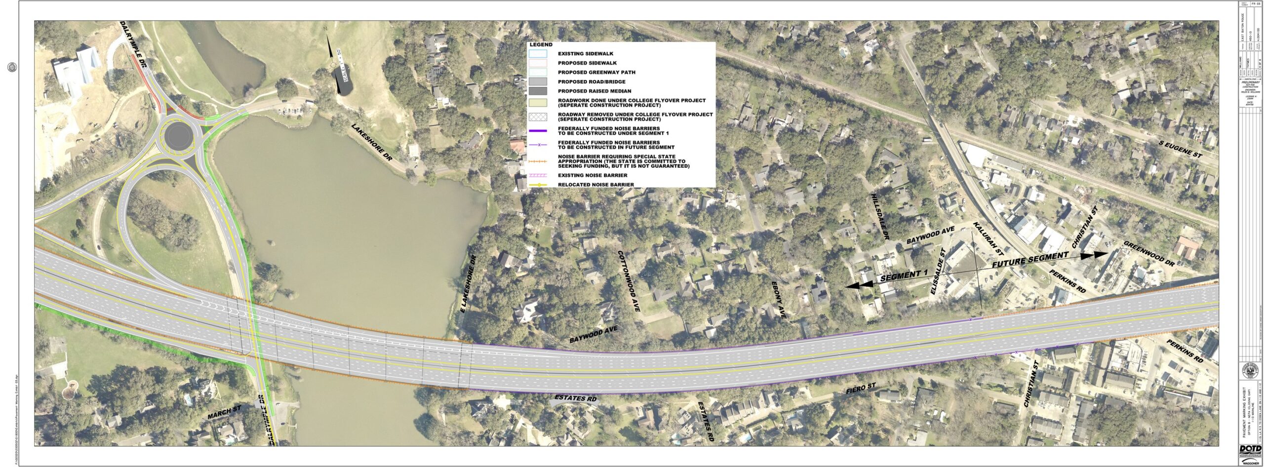
In addition to interstate capacity improvements, key features shown on plan Sheet #3 are:
- A roundabout on Dalrymple Drive at E. Lakeshore Drive will facilitate the flow of vehicles.
- The new I-10 bridge over City Park Lake will feature signature design features. Learn more on the CSS improvements page.
- A multi-use path greenway will connect the University Lakes bike/ped facilities (by others) with existing bike/ped routes downtown.
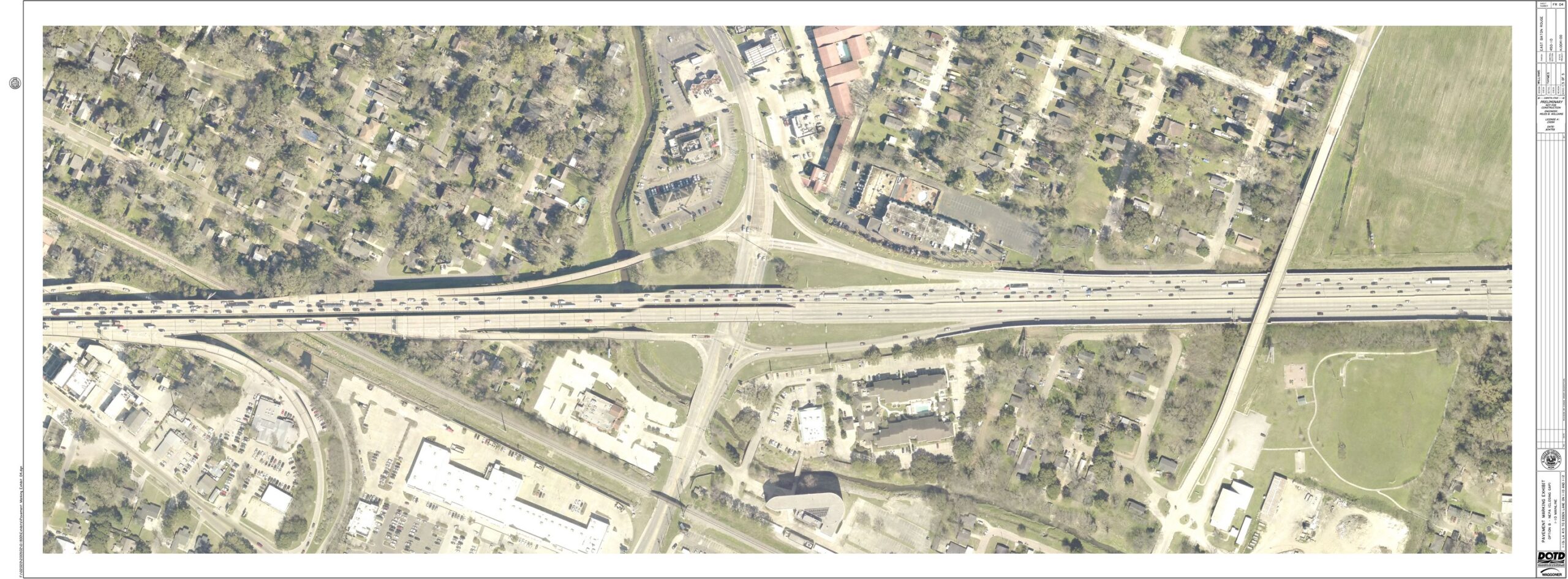
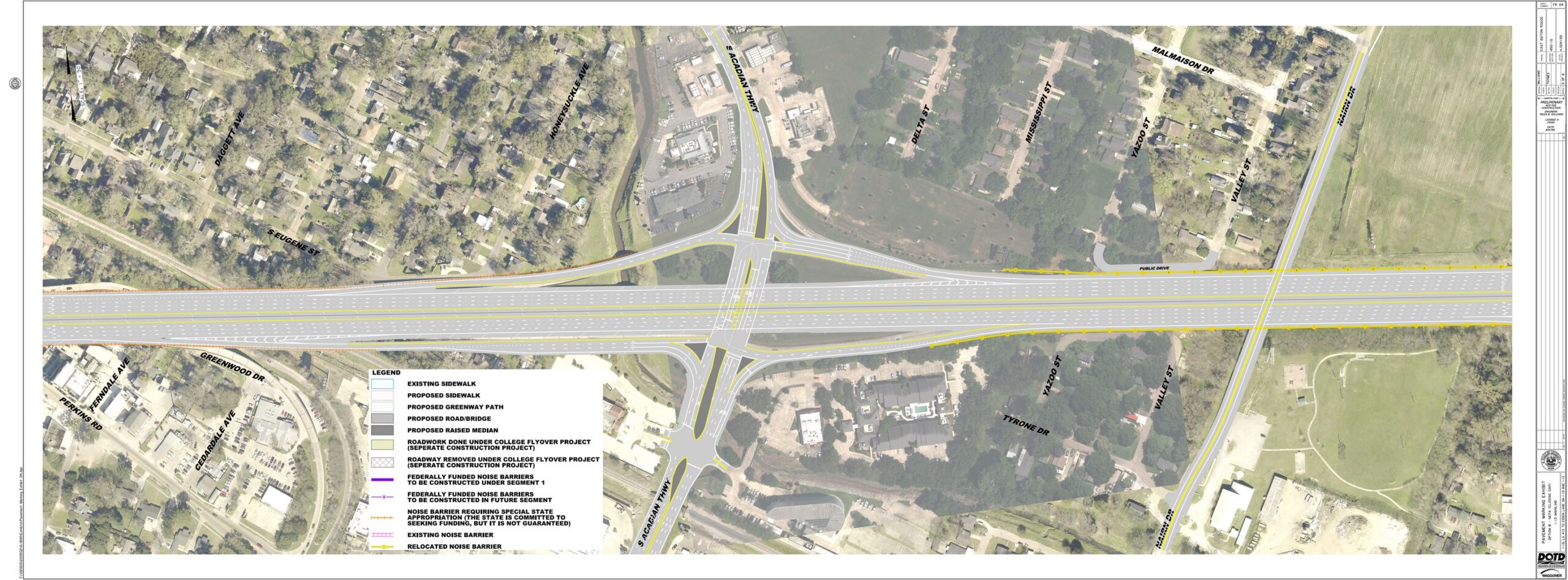
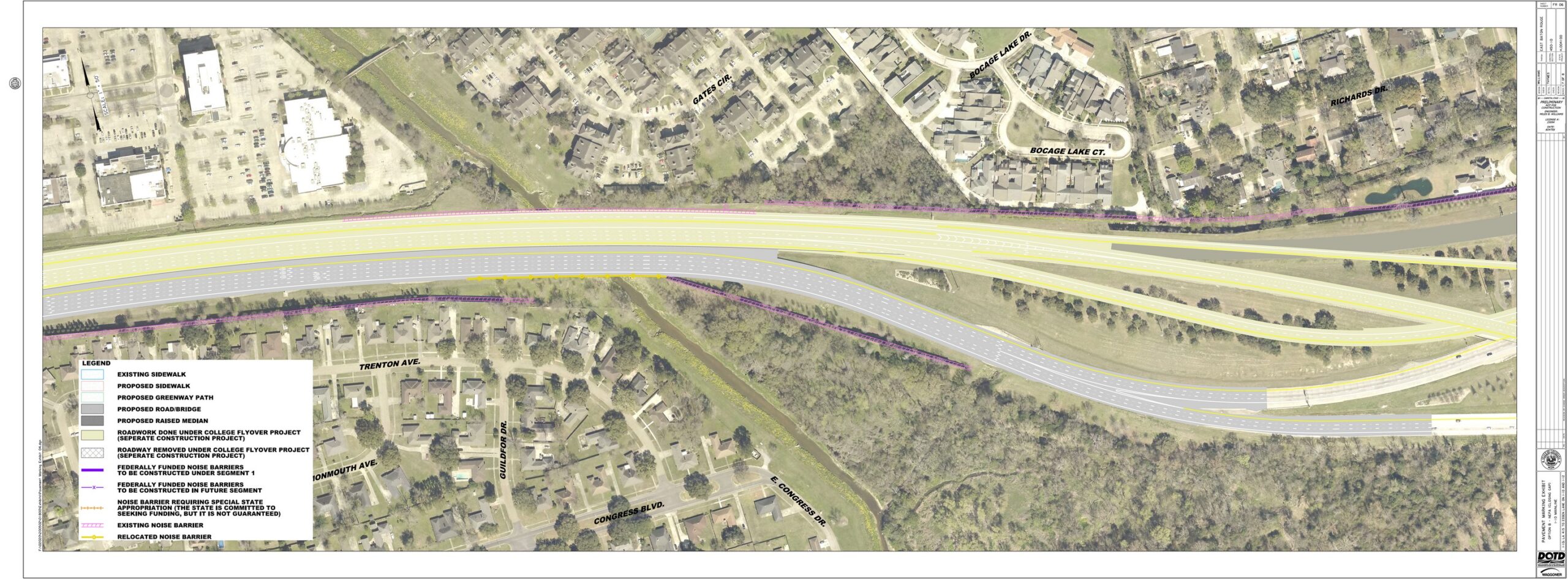
Key improvements illustrated by plan Sheet #4 include the following, listed from west to east:
- The on and off ramps at Perkins Road will be permanently removed.
- The I-10 eastbound exit to S. Acadian Thruway will be elongated, as will the on ramp to I-10 westbound from Acadian.
- Context Sensitive Solutions (not shown) are planned for the State right of way in the Perkins Overpass area to provide amenities such as improved parking for the community and local businesses.
- Capacity improvements are planned for S. Acadian Thruway, in part to compensate for removal of the Perkins Road ramps.
- Widening of I-10 between Acadian and College Drive requires replacement of the Nairn Drive bridge. The new Nairn bridge will be wider and will fully span the interstate with no support pier. CSS amenities including a multi-use path and aesthetic enhancements are also part of the new bridge design.
- Noise walls will be relocated or replaced as funding permits.
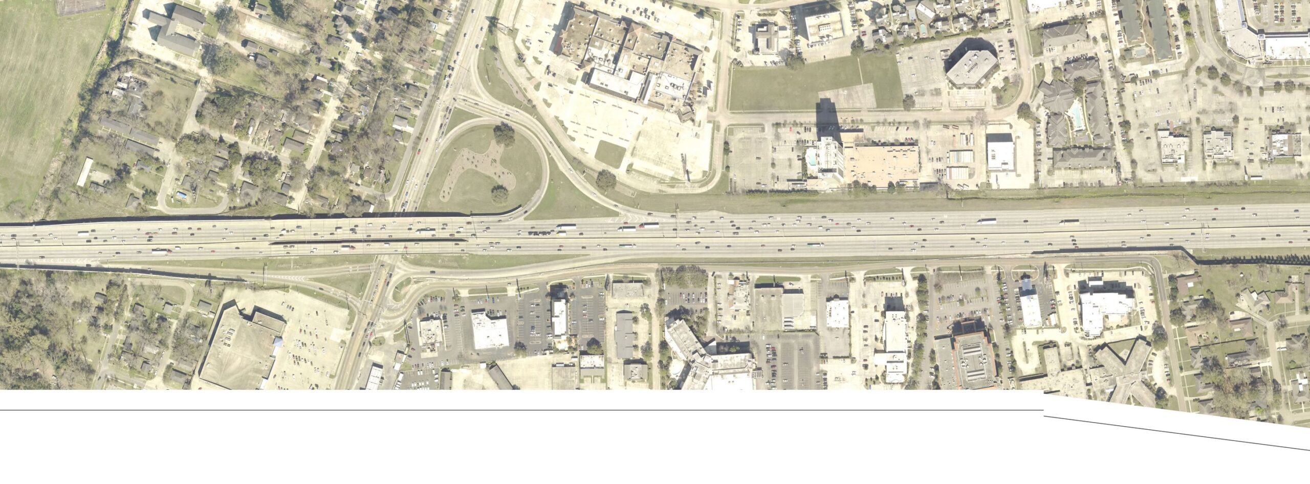
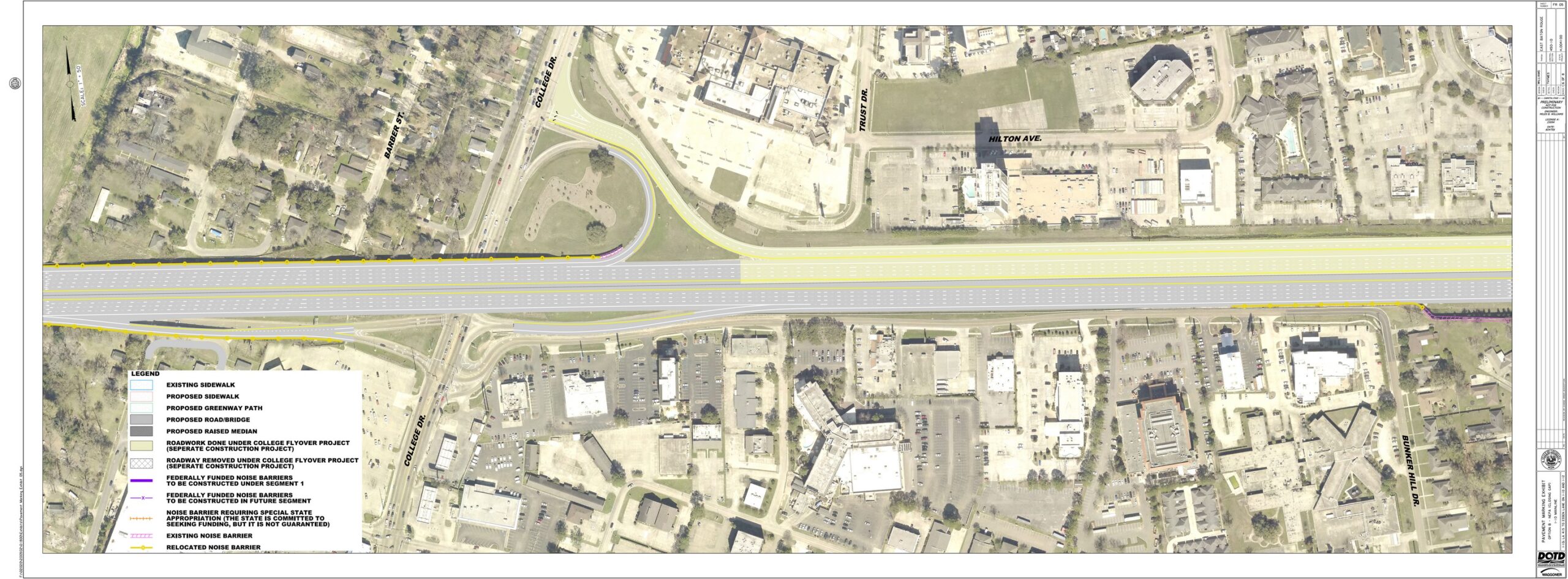
The capacity improvements for I-10 at the College Drive interchange will require replacement of the interstate bridge spanning College Drive to accommodate the additional I-10 travel lanes.
Plan Sheet #6 shows both completed and proposed improvements as follows:
- An additional lane is proposed as a capacity improvement for I-10 eastbound from College Drive. At the split three lanes continue east on I-12 and three lanes proceed east on I-10 towards New Orleans.
- Improvements to I-10 westbound from Essen Lane to the east side of College Drive were completed in 2025 through the College Drive Flyover I-10 westbound Exit project (State Project Number H.013897).
Phase 2
LA 415 to W. of Washington St.
Phase 2 of the I-10 Widening Project is primarily within West Baton Rouge Parish, extending from the LA 415 (Lobdell) interchange east across the Mississippi River to west of Washington Street. Plans for Phase 2 have not advance beyond the preliminary design as described in the environmental document. It will undergo final design and implementation when funding is available.
Community Connections
This project includes community improvements within State right-of-way.
Following completion of interstate construction, LADOTD will provide improvements identified as Context Sensitive Solutions (CSS) which are in accordance with FHWA’s Community Connections program and described within the project’s environmental document. Final plans for these improvements which include multi-use paths, paved parking, lighting, and more, are in development. Provision of community amenities requires agreements from local government and partner agencies to provide ongoing maintenance.